
PeakVisor - 3D Maps & Peaks ID
November 11, 2024More About PeakVisor - 3D Maps & Peaks ID
"A lovely little app that uses your phone’s camera and the power of augmented reality to identify any mountain you aim the camera at." - Digital Trends
Key Features:
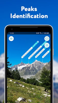
● Mountains Identification
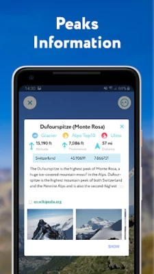
Identify more than a million hills & mountains all over the world and get a detailed profile for each one of them, including altitude, topographic prominence, mountain range, what national parks or reserves it may belong to, as well as photos and Wikipedia articles. It is one of the most useful Augmented Reality technology applications on the market today.
● 3D Maps
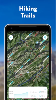
Get your topo maps of the future. Cutting edge technology with high-precision terrain modeling allows simple, yet effective insight into the landscape of the mountains. It is the most convenient way to explore a mountainous area, its trails, summits, passes, viewpoints, and even parking areas.
● Hiking Route Planner
A vast network of worldwide hiking trails and walking pathways included in PeakVisor’s 3D Maps will help you compose a hiking route, which includes, evaluating the distance you can expect to hike, as well as a route’s elevation profile, and estimated time for completion. To help you plan your route we’ve included points of interest in our 3D Maps such as mountain huts, parking lots, cable cars, viewpoints, castles, etc.
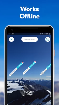
● Everything works Offline
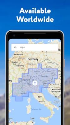
Internet connection is not a prerequisite for the PeakVisor app. All the data is downloadable and ready for use no matter where you are or what altitude you might be at.
● Identifying Mountains in Photos
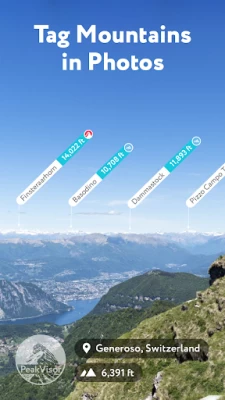
If you have photos from previous hikes that you did not take through the app, you can still find out what peaks you saw by download your images into the PeakVisor app and adding a digital overlay of the mountains with names and altitudes of all the peaks in view.
● Photo Planning
PeakVisor’s Sun and Moon trajectories come super handy when planning the perfect time to take pictures.
PeakVisor is the Swiss army knife of outdoor adventure and will soon be indispensable to you future hiking needs. Just keep it in your backpack and you'll get value from it every time you’re on the trail!
If you have any questions or just feel like talking about mountains, please contact us at peakvisor@routes.tips
Latest Version
2.8.71
November 11, 2024
Routes Software SRL
Travel & Local
Android
30,142
$4.99
tips.routes.peakvisor
Report a Problem
User Reviews
Ian Noel Pace
1 year ago
Way off.... 10km far peaks shown as 52m away... Does not cover the 200km range. Waste of money. Avoid
Hikingphotobug
5 years ago
The views and information were far more limited than I expected. After a short while the app just crashed repeatedly and wouldn't stay open. Great idea unfortunately it's not working on the Samsung S10 plus
tina fajardo
2 years ago
How do I get a refund? And is the fee a one-time charge? I have issues surrounding the accuracy. I used it and it identified mountains but the lines they are pointing at are WRONG. I just downloaded this app yesterday Aug 15 and would like to cancel if this is a subscription and get my money back.
Tony Westenhofer
3 years ago
Looks extremely cool at first glance, but already stuck... It crashes when loading my GPX Caltopo built track. Tried a couple different files with same result. Will stay hopefully it will be stable soon! Off to hunt for an error log.
Jacques
4 years ago
I bought this app for the purpose of tracking my hikes, but I can't see this option anywhere in the app. The only options I see are Teleport, Photo Import and Local Search. No other options except for settings. How can one track the hikes? Other apps I use, one simply open the open and click on 'start tracking'.
Willie S
3 years ago
Was previously using View Ranger which was far superior. This app claims functionality without a signal but this isn't accurate. You must DL the area in advance for it to work. Even with a signal, you have to wait on the DL & use data to identify a peak. Too slow of a process during a hike.
Katelyn Shortt
5 years ago
Such a cool app to have! Very very easy to use. Just point it at the landscape and it accurately tells you what mountains and peaks are there. I was hesitant to get it because of the bad reviews, but it is awesome. Highly recommended if you like learning the names of local mountains.
Anthony Kerwin
5 years ago
Not enough relief. No distinguishing features. It might be fine with only a few major peaks, but in my area, southern Oregon, from the top of a big peak, it names 12 or peaks, each a small lump indistinguishable from the mass of hills. Far away peaks on the horizon do not show up at all.
John Thompson
4 years ago
I like the look of it, but it rarely matches up with mountains and can be glitchy. You have to line up the mountains yourself, based on the shape of range. Potential, but falls short for an app you pay for, in my opinion
A Google user
7 years ago
The app force closes with the latest update. Unusable in its current for with Android Pie. Great app before aside from the compass, which never automatically aligned - always had to manually adjust it. Update: Developer fixed the app after becoming aware of the issue. Compass is currently tied to the magnetometer hardware of the phone.
Kamran Razvan
1 year ago
Amazingly simple and useful. Used it while hiking in Switzerland and made the experience much better.
Jason Tranter
1 year ago
This app is amazing if you have ever wondered "which mountain is that" or "which peak is Mount Whatever".
Haady Othman
1 year ago
A great app for mountain identification here in Malaysia. Been using it for mountain bagging since 2021. My current issue I can't use the import picture to identify peaks function anymore. It's only composing panorama and then the app just literally shuts down.
Hanmin Su
1 year ago
possible to add the function that can check in the peak without internet? A bit frustrating that Taiwan got some mountains there is no telecom cover...
Erik Stejanko
1 year ago
Used it for about 3 weeks. Pictures come in incredibly dark, with lots of color distortion. Additionally, after each picture, a response for a review is requested. Gets annoying. Two stars for the major color issues and the prompt ask after each picture
Patrick Bangerter
1 year ago
Very disappointed. I paid for this after seeing it on a friend's iPhone where it was awesome. On Android, the so-called high definition 3D map are totally blurred. In addition, it seems that winter mode is not working as no change in the map when toggling it on/off. Can't believe I paid for this... I'll try it a few days and most likely will ask for a refund. Too bad.
Mark Suhhin
1 year ago
Have zero idea about iPhone app, but this app is not even a millimeter close to the stuff you see on the website and has basically no claimed features. The devs go a long way to compare themselves to FATMAP and claim they're the next best thing - maybe on other platforms, but on Android it's horrible. The UI is jittery, map is inaccurate, no routes, visuals are from 90s. Advise to devs - just take down the app and release when you are actually ready.
John Bramer
4 years ago
I've heard it's much better on the iPad but the interface for Android phones is very wonky. The tutorial is ineffective at teaching the basics of the app and the menus are confusing. If all you're looking for is peak naming, PeakFinder would be better. No useful route and trail info in the app even though they advertise it.
Matthew C. Shillings
2 years ago
I feel like I wasted my money on this app. The iPhone version is so much better. This feels like the annoying little brother that wants to do everything big brother does but just embarrasses it's self. It never knows which way it's pointing. You have to drag across the screen & hope you can line up the mountains. You also better have rock steady hands, one tiny move, and the whole outline freaks out and moves so that you are always fighting to keep it lined up. This feels like the wish version.
George Hartman
1 year ago
I live in the Colorado mountains and I've been using this app for a couple of years - it's awesome. You can be in one spot and know exactly the mountains you are seeing. Move a few miles and the perspective changes. Drive a few miles and wonder what the names of the new mountains you're seeing might be? Bring up Peak Visor, match the app profiles to what your phone camera sees and you have the answers.
